The interactive StoryMap, “Downtown Brooklyn: Twenty Years of Growth,” explores the revitalization and transformation of Downtown Brooklyn into a bustling mixed-use neighborhood.
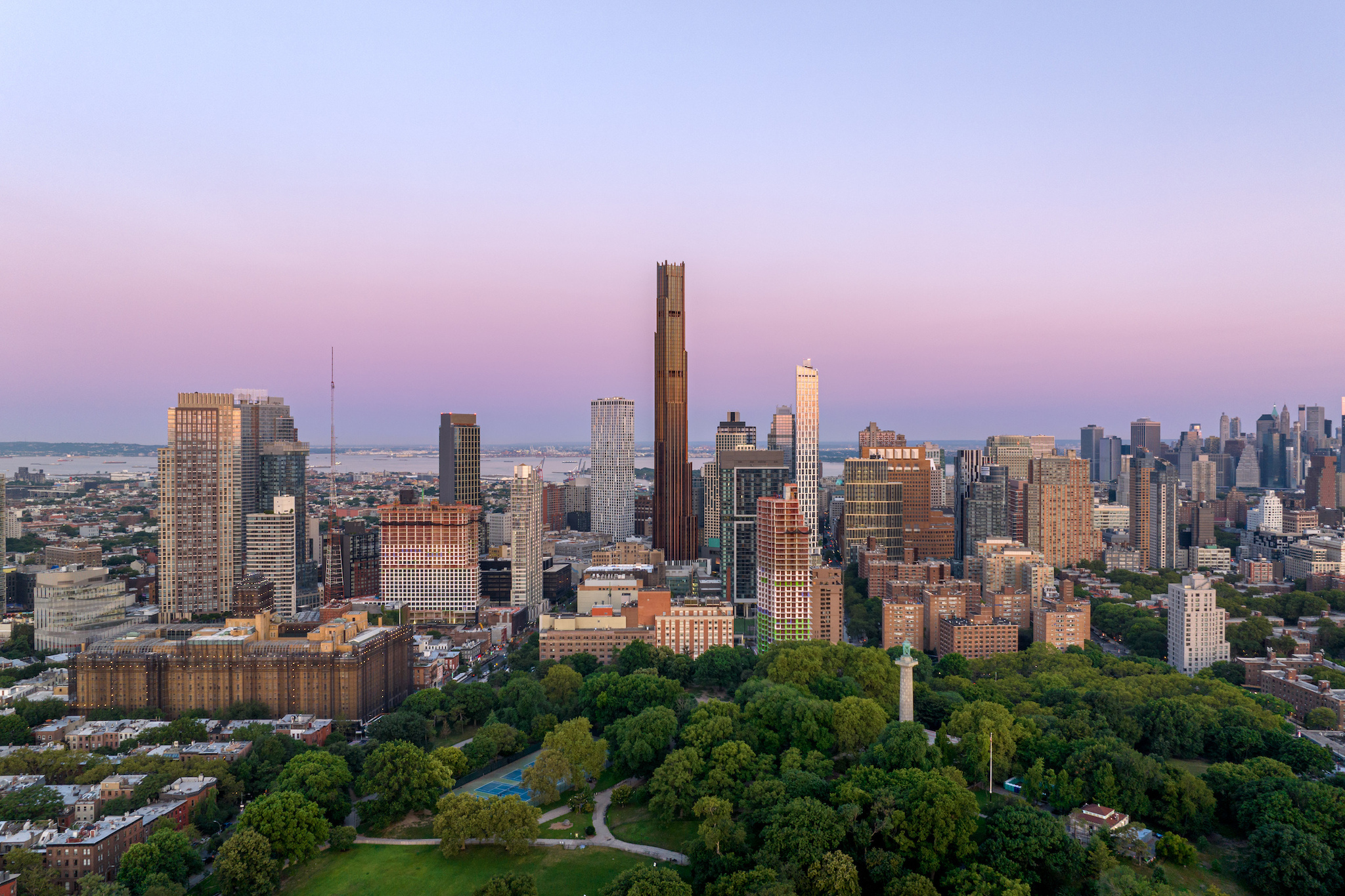
Downtown Brooklyn: Twenty Years of Growth uses maps and graphics to offer a dynamic look at the remarkable transformation of the neighborhood since its 2004 rezoning. Over the past two decades, Downtown Brooklyn has experienced unprecedented growth, adding over 32 million square feet of new development in residential, commercial, spaces. The interactive StoryMap* uses Google Street View and historic images to look at two decades of progress that took Downtown Brooklyn from a commercial and civic center to a vibrant mixed-use neighborhood.
“The last 20 years have shown that the rezoning of Downtown Brooklyn was an overwhelming success, attracting billions of dollars of investment to reshape the neighborhood into a thriving downtown that supports residential, commercial, educational, arts and culture, retail and a multitude of other uses,” said Regina Myer, President of Downtown Brooklyn Partnership. “Downtown Brooklyn: Twenty Years of Growth” provides an in-depth, visual look at just how far-reaching the economic impacts of the rezoning have been, from making our streets safer and open spaces livelier, to creating new housing and infrastructure to support an increasing population that wants to live here. We are excited to commemorate twenty years of growth in Downtown Brooklyn and look forward to continuing our work to make this neighborhood a premier destination.”
As New York City’s third largest business district, served by 13 major subway lines and located adjacent to Manhattan and Brooklyn’s most desirable residential neighborhoods, Downtown Brooklyn was uniquely positioned for revitalization. The Downtown Brooklyn Development Plan, passed in 2004, called for extensive rezoning, increased the Floor Area Ratio (FAR) cap for cultural and educational institutions, eased restrictions on ground-floor retail, and investments in open space, subway improvements and the development of the Brooklyn Cultural District. This served as the catalyst for Downtown Brooklyn to receive over $24 billion in private investment and over $2.4 billion in public investment over the last twenty years.

These key facts and figures ILLUSTRATE the impacts of the rezoning twenty years later:
HOUSING AND POPULATION
- Downtown Brooklyn accounts for 5% of new housing development in the city, despite only making up 0.3% of its land.
- Downtown Brooklyn has added over 22,000 new housing units, with 8,000 more in the pipeline.
- 20% of this new housing is affordable, totaling 4,500 units built and 2,000 more in progress.
- Downtown Brooklyn’s population has increased 57%.
Office, innovation + jobs
- Downtown Brooklyn has added nearly 2.8 million square feet of new or repositioned office space.
- Downtown Brooklyn saw 40% private sector job growth in the technology, professional services, and creative sectors.
- Private sector employment surged from 62,000 jobs in 2012 to over 86,000 in 2022.
Public Realm
- New public open space highlights include the openings of Abolitionist Place, Albee Square, Willoughby Square, Fox Square, and Betty Carter Park.
- In 2021, DBP released its Public Realm Action Plan, which outlined public realm improvements that prioritize people and the environment, such as widening sidewalks, adding Shared Streets to the core network, planting new trees and green infrastructure, and streamlining public transportation networks.
TRANSPORTATION + STREETSCAPE
- The rezoning led to key transit improvements including the $108 million Atlantic Terminal, $164 million in upgrades to the Jay Street-Metrotech station and the $76 million Barclays Center subway entrance.
- Over 3,000 parking spaces have been removed since the rezoning, prioritizing other sustainable modes of transportation and repurposing valuable land for housing, businesses, institutions and community spaces. The land once dedicated exclusively to parking facilities in 2004 now contains over 9,700 residential units and 3.5M sq. ft. of commercial space.
- Eight bike lanes have been added to enhance cycling infrastructure, including protected bike lanes on the Brooklyn Bridge and along Schermerhorn Street.
- Dedicated bus-only lanes were added to Livingston Street to improve traffic flow and pedestrian safety.
retail, entertainment + dining
- The opening of City Point in 2016 added 1.9 million square feet of mixed-use space for Target, Trader Joe’s, Alamo Drafthouse Cinema and DeKalb Market Hall.
- Following the renovation of 345 Adams Street in 2011 and Willoughby Plaza opening in 2013, a vibrant pedestrian plaza surrounded by eateries emerged.
ARTS + CULTURE
- Over $187 million in public investments have been made in the Brooklyn Cultural District, including BAM Fisher, BRIC Arts Media House and UrbanGlass, Polonsky Shakespeare Center, the Center for Fiction, and L10 Arts and Cultural Center.
- The arrival of Barclays Center in 2012 and the renovation of the Brooklyn Paramount in 2024 brought the NBA, WNBA, large-scale entertainment and touring musical acts to the neighborhood.
HIGHER EDUCATION
- Higher education enrollment in Downtown Brooklyn now stands at over 35,000 full and part-time students.
- NYU Tandon expanded into 370 Jay Street and recently purchased 3 MetroTech Center. CUNY City Tech opened a new academic building, St. Francis College moved to a new location on Livingston Street and Long Island University (LIU) have been upgrading their campus through public/private partnerships.
HOTELS + TOURISM
- Initially, only one hotel existed in the area but in the last two decades, nine new hotels with over 1,900 rooms have opened including from major brands like Ace, Hilton, Marriott and IHG.
*ABOUT ARCGIS STORYMAPS
ArcGIS StoryMaps is a web-based story telling platform that creates interactive narratives by combining maps, multimedia content, and text to communicate stories in a visually engaging way. StoryMaps allows users to embed photos, video, audio, web content, web maps and web scenes.